| Issue #78 • November/December, 2002 |
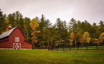
Over the 4th of July weekend, my wife and I learned an important lesson the hard way. We live near Kansas City, but for several years we’ve owned 40 acres in the Missouri Ozarks. It’s close to true wilderness, with immense old oaks, abundant wildlife, plenty of solitude, and only a single, axle-snapping dirt road in.
We visit our land frequently to camp, cut wood, and imagine where our cabin will rise in a few years after the kids are on their own. Often we would hike for acres under an unbroken canopy of hundred-year-old oaks and hickories. But that weekend we found an area where we could never do that again. Several acres of the oldest and most beautiful trees in our forest had been cut.
The land next to ours had recently changed hands, and our new neighbor was putting it to productive use by harvesting the timber. His crew had already cleared most of a hillside. Unfortunately, some of that hillside belonged to us.

Or so we believed, and here is where our lesson began.
When we walked the land with the realtor years before, faded survey tape hung in the low branches of the trees. This was pointed out as our western boundary, and that seemed perfectly adequate. The next spring, though, a ground fire swept through, consuming the tape. We knew where the line ran, but we couldn’t prove it.
That weekend when we first viewed the piles of treetops and the big equipment ready for more work, we realized we had to let our neighbor know of the mistake before more of our trees fell. We got his name and address from the county, and sent him a letter saying, in a reasonable, calm way, that we believed the logging had crossed our property line and that we needed to get it resolved. We didn’t phone him for two reasons. First, a letter gave us time to calm down and think through what we wanted to say. There was less chance of saying something we would regret later. Second, the county didn’t have his phone number and he wasn’t in the book.
Fortunately, when our neighbor called after receiving the letter, he was also reasonable and calm. He explained that he was confident he hadn’t crossed our line and that we were mistaken in where it ran but that he would stop cutting that area until it was worked out. He said that when he bought the land, the prior owner showed him where the boundary was. He did say that if it turned out he was mistaken, he would take responsibility, but he doubted there was an error. In the absence of proof, it was simply our claim against his.
Mistakes from the past
And the problem grew worse. Not only did we have no evidence of the line, but we soon learned that we didn’t even have a survey. Years before the land had been surveyed, but the company that did the work had long since gone out of business, and the records were transferred to a different company. Whatever documentation survived from the past was jumbled and confused.
Not only had our trees been taken, but now we had to question whether they had ever been our trees at all. I didn’t curse the realtor for the same reason I hadn’t called the sheriff or carried a rifle to my neighbor’s doorstep as all our friends had suggested. At that point, we simply didn’t know anything for certain.
Looking back now it seems insane that we owned 40 acres in a perfect square but didn’t have a survey to show where the four sides were. We were naive, and we were paying the price.
Our next step was to get a new survey. We contacted the company that received the original records and scheduled a visit. Because of their workload, several weeks passed before they came out. By then it was mid-August, when the temperature soared, horseflies bit, and leaves hung in the undergrowth and remaining trees. If we had the luxury of time, we could have waited until November when the leaves had fallen, the bugs were gone, and the temperature was more work-friendly.
Compounding the confusion was a missing peg at our northwest corner. The earlier survey referenced a pile of stones, but this wasn’t a legal definition, so we had to establish that point before we could find the line. This took extra days of research and marching through the woods. In the end we spent more than $1000 drawing an imaginary line a quarter mile through the Ozarks. But that gave us an indisputable western boundary, with steel pegs at two ends and stakes at regular intervals along it. Best of all, it was right where the survey tape used to hang. We were right, our neighbor was wrong, and now we could prove it.
The following weekend my son and I sank six-foot steel posts along this line and at our four corners, then painted their tops bright orange. I’ve never liked PRIVATE PROPERTY signs on trees. They’re unfriendly and jarring in the middle of the woods. But that day we added several to the remaining trees along our western line.
Weeks had passed since I’d last spoken to my neighbor, so when he received our second letter with a copy of the survey, he called to say he thought we’d forgotten the whole dispute. He also said he was upset to learn he did make a mistake. He apologized and insisted he never would have cut the trees had he known. Then he offered to compensate us.
Sorting it out
Valuing timber was not something either of us had any experience in. He knew how much a truckload of trees earned him, but it was impossible to estimate how many truckloads our trees made. Furthermore, different species had different values. That part of the woods had a mixture of hickories and several kinds of oaks.
To sort it out, I hired a professional forester. The state conservation department will value trees for landowners, but it won’t get into a dispute like this. I got a list of foresters and started by calling the first name and continued until I reached a human voice.
When we met the forester on our land on a beautiful Monday in September, he got right to work. He was methodical and thorough. He examined each stump, measured its diameter, found its treetop left lying where it had fallen, measured its diameter, and measured the distance between the two, taking into account any sliding the tree might have done when it fell. From this he could calculate the number of board feet the tree contained. He also noted the species. Then he painted the stump blue so we wouldn’t measure it again.
When I had described the cutting to him over the phone, I said there were maybe 30 trees taken altogether from the two acres. By the time he finished, he’d found 85 stumps and suspected there were at least ten more buried under the fallen treetops. He recorded every detail and took all of the data back to his computer to calculate the value of the trees based on current, published timber prices.
A detailed report arrived a week later. It specified a dollar value for the trees that was more than we expected but less than the costs of the survey, the forester, and legal advice once we added them up. Fortunately, in a case of timber trespass Missouri law favors the victim, and the landowner is entitled to three times the value of the trees taken.
With all of this information in hand, we wrote our neighbor a third time, including a copy of the forester’s report. We outlined a worst-case scenario, showing all of our costs and the triple value of the timber. It came to a lot of money.
Then my wife and I did some soul searching. The trees were gone and wouldn’t be back in our lifetime. No amount of money was going to change that. Our neighbor seemed to have made an honest mistake that he regretted. Was it right to punish him to the full extent of the law? Did we want to be bullies who got rough justice then scurried back to suburbia? Did we want to create hard feelings with a man who would someday be our neighbor?
Yet we spent thousands of dollars because of his mistake. We lost our favorite part of the forest forever. The wood taken was equivalent to 10,200 board feet, enough to frame a 2,000 square-foot house. Most important, if we didn’t fight back, any of our other neighbors might take it as a sign that we didn’t care or wouldn’t object.
Two weeks of silence followed. Then a letter came, not from our neighbor but from his lawyer. He stated our demands were unreasonable, though we hadn’t actually demanded anything. We had merely outlined our costs and pointed out what a judge could award if we settled in court. Our plan was to suggest how bad it could be so that we might negotiate to a more reasonable number. Apparently they got the point because the lawyer counteroffered with an amount less than one-tenth of our total. Even if those trees had been trash timber, they would have brought more than his offer as firewood in Kansas City.
Now the dispute rests with our lawyers. I’ve tried to come up with compromises. I’m willing to average his value of the trees with the forester’s. I’m willing to forget the triple damages. I’ll take out the cost of the survey. If I had gotten a survey before we bought the land, this whole mess wouldn’t have happened. I’m told these things take time but eventually something satisfactory to both sides will be reached. In the end, I suspect the only ones who will be satisfied will be the lawyers.
Plans for the future
In the meantime we haven’t been idle. My wife and I have mailed a topographic map of the 40 acres to each of our neighbors, showing where their land touches ours and asking that they contact us if they have any question about where the property lines fall.
We’re clearing out the treetops that lie scattered across the two acres. One thing they have done for us is put a lot of firewood within easy reach now. In the spring we’re going to plant hawthorn trees there. They have fragrant flowers, and in the fall their tiny apple-like fruits will feed the deer and squirrels. It won’t be a mature forest again in our lives, but in five years it will be nice, and the remaining evidence of the unfortunate harvest will be turning back into soil.
There are many ways to look at a forest, and each way can be legitimate. My neighbor looked at his and saw acres of mature hardwoods ripe for harvesting. He could make a fair income and open the tree canopy to speed the growth of the next generation of trees. My wife and I saw our forest as wilderness, more alive and interesting than suburbia’s manicured parks. We could enjoy its richness, and the wind could be counted on to take down the right trees to open the canopy.
Both views can co-exist, and a clear property line is what makes this work. I respect my neighbor’s right to harvest his trees. I think he respects my right to enjoy a mature forest. The lack of a clearly defined property line hurt us. We’ve both learned hard lessons.
Lessons learned
- Have a survey done or get a copy of the most recent survey. The memory of a former landowner may grow faulty or be wrong to begin with. Make a survey a condition of the sale if you’re buying land. Record the survey with the county.
- Mark your border as you see fit: blaze trees, set out signs, raise a fence or line of posts, clear a firebreak, pile rocks, hang survey tape, plant hedge roses. Renew your markings yearly.
- Get to know your neighbors, or at least let them know you’re paying attention. Send them a copy of your survey. Walk the line with your neighbor and be sure you agree on where it lies. Goodwill and vigilance early is better than anger and regret later.
- Learn and understand what easements affect your property. Your neighbor may have the right to build a road across your land. Better to learn this in advance than when the bulldozer arrives.
- Learn your state’s rural property laws. In some states, a landowner must contact all of his neighbors before doing large-scale timber harvesting. He may also be restricted from cutting any closer than within twenty feet of his property line.
- If you have a dispute, stay calm, civil, and reasonable. Arm yourself with the objectivity of unbiased professionals. Don’t lose your fight by losing your temper.


